- Anime
- Evangelion
- Area
- Hakone, Kanagawa
- Routes
- On 1 route
- Sources
- 6 official pages
Hakone is the model for Tokyo-3, the fortified city of the series. Hakone Town runs an official Evangelion collaboration, with themed public facilities in the Sengokuhara area.
Written and checked by AnimeTrails Editorial
Please be a considerate guest: keep your voice down, keep paths clear and leave the place as you found it.
Getting to Hakone-Yumoto Station
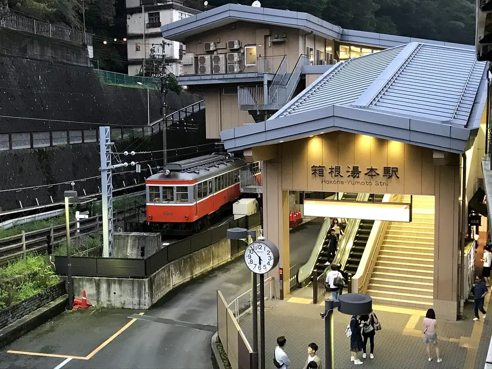
The Hakone Tourist Association gives these routes: from Odakyu Shinjuku Station, the Romancecar limited express takes about 85 minutes. From Tokyo Station, the Tokaido Shinkansen reaches Odawara in about 35 minutes, and the Hakone Tozan line then takes about 15 minutes to Hakone-Yumoto. Odakyu's station page lists connecting buses run by Hakone Tozan Bus, Izu Hakone Bus and Odakyu Highway Bus, and notes an elevator from the gate to both platforms.
The general tourist information center is outside the gate. Turn left, cross the pedestrian deck over National Route 1, and it is on the ground floor of the building in front of you.
The 2020 collaboration in Hakone
From January 10, 2020 the town and the franchise ran a campaign that continued through September 30, 2020, including a stamp rally built on a map that overlays real Hakone onto the series' settings. Hakone-Yumoto Station and a themed shop named Hakone-Yumoto Evaya were among the stamp points, and the town's tourism pages describe Togendai Station as the series' Tokyo-3 station. The campaign was dated, so check the current event pages before you go.
Sengokuhara facilities
The town's public-private redevelopment of the Sengokuhara area began in August 2018. One collaboration project was the rebuilt public restroom at Kintoki Park, in service since February 2020, and the tourism association lists an outpost location at Kintoki Park and the Mt. Kintoki trailhead.
Station map
Getting there
On these lines
Trips that visit this place
Same series
More Evangelion places
Close by
Other anime places nearby
Straight-line distance between the two sets of coordinates, not walking or transit time.